
21 Pisgah National Forest Waterfalls For Adventure (2024)
Pisgah National Forest is a dream come true if you love the outdoors and natural beauty. We spent some time exploring the Pisgah National Forest waterfalls, so we will also share what NOT to do at a few of the falls as we made some serious mistakes along the way – Cedar Rock Falls, I’m looking at you!
We don’t want you to have to experience an unplanned 3-hour hike uphill, with no food, like we did. 10/10 do not recommend that. Get your hiking boots ready and let’s dive into Pisgah’s waterfalls….
Just make sure they’re deep enough first. We don’t want any injuries 😉
Culture Craving Couple contains affiliate links and is a member of the Amazon Services LLC Associates Program. If you make a purchase using one of these Amazon links, we may receive compensation at no extra cost to you. Thanks for supporting us! You can see our disclosure policy.
Quick Links:
Where is Pisgah National Forest?
So where is this slice of woodland paradise? You’re going to want to set your compass Google Maps GPS (because who uses a compass anymore) to the western part of North Carolina!
Nestled mostly among the southern Appalachian mountains and spanning into parts of the Blue Ridge Mountains and Great Balsam Mountains, Pisgah Forest North Carolina is entirely contained within North Carolina.
The forest is easily accessible from cities like Brevard, Barnardsville, Linville and Asheville, making it a great addition to visiting the Biltmore. It is not a smart idea to go from Charlotte to Asheville just for one day due to the travel time. However, it does make a good weekend getaway from Charlotte,
If you need to rent a car to get to the National Forest, we always recommend Discover Cars!
>> You can click here to check prices on car rentals from your city of choice! <<
1. South Harper Creek Falls
District: Grandfather Ranger District
Hike Length: 2.8 Miles
Parking Situation: Small parking area of Forest Road 58
Hike Difficulty: Moderate
Location: Accessible via the trailhead on FR58 (also known as Old NC 105 or Kistler Memorial Highway)
This is one of the highest waterfalls in the Grandfather Ranger District. The falls are nearly 150 feet tall and have two tiers, making them incredibly beautiful.
Know Before You Go: Once you reach the Raider Camp Trail along the Harper Creek Trail, you can choose to see the falls from the top or bottom. Do both!
2. Upper Creek Falls
District: Ranger District
Hike Length: 1.6 Miles
Parking Situation: Signed parking area between Pineola and Jonas Ridge.
Hike Difficulty: Difficult
Location: Accessible via the trailhead located off NC Highway 181.
These beautiful Pisgah waterfalls are 50 feet high and have a serious swimming hole complete with a rope swing. You could visit the swimming hole, climb the top of the falls, or just hike the loop!
Know Before You Go: The top of the falls is very slippery and people have died here. So, be very careful here!

3. Elk River Falls
District: Appalachian Ranger District
Hike Length: Less than one mile
Parking Situation: Small parking area.
Hike Difficulty: Easy
Location: near the town of Elk Park and has an access point in the woods just outside of the town, on Elk River Road.
This plunge waterfall drops 50 feet into a pool of water making it very popular in the Summer. It is a short hike with lots of places to lie around, sunbathe, or have a picnic.
Know Before You Go: Almost every year someone dies here. Do NOT get into the water above the waterfall as the currents are very strong and fast. Do not dive from the rock cliff or try to swim UNDER the falls. Use your noggin!
These falls used to be called “Big Falls” so you may signage for that.
4. Douglas Falls
District: Appalachian Ranger District
Hike Length: 6.6 Miles round trip
Parking Situation: Available at Craggy Gardens Visitor Center on Blue Ridge Parkway at mile 364.6
Hike Difficulty: Moderate to difficult
Location: The trailhead is off Forest Road 74, which may be called Douglas Falls Road on your map.
These 70-foot falls are tucked away in the Big Ivy area which is much less visited than other areas. The waterfall drops below an overhanging cliff and you can walk behind it! The flow is usually low which makes it a great hangout spot.
Know Before You Go: This is a long strenuous hike that is recommended for experienced hikers. If you walk behind the falls be careful as it is very slippery.
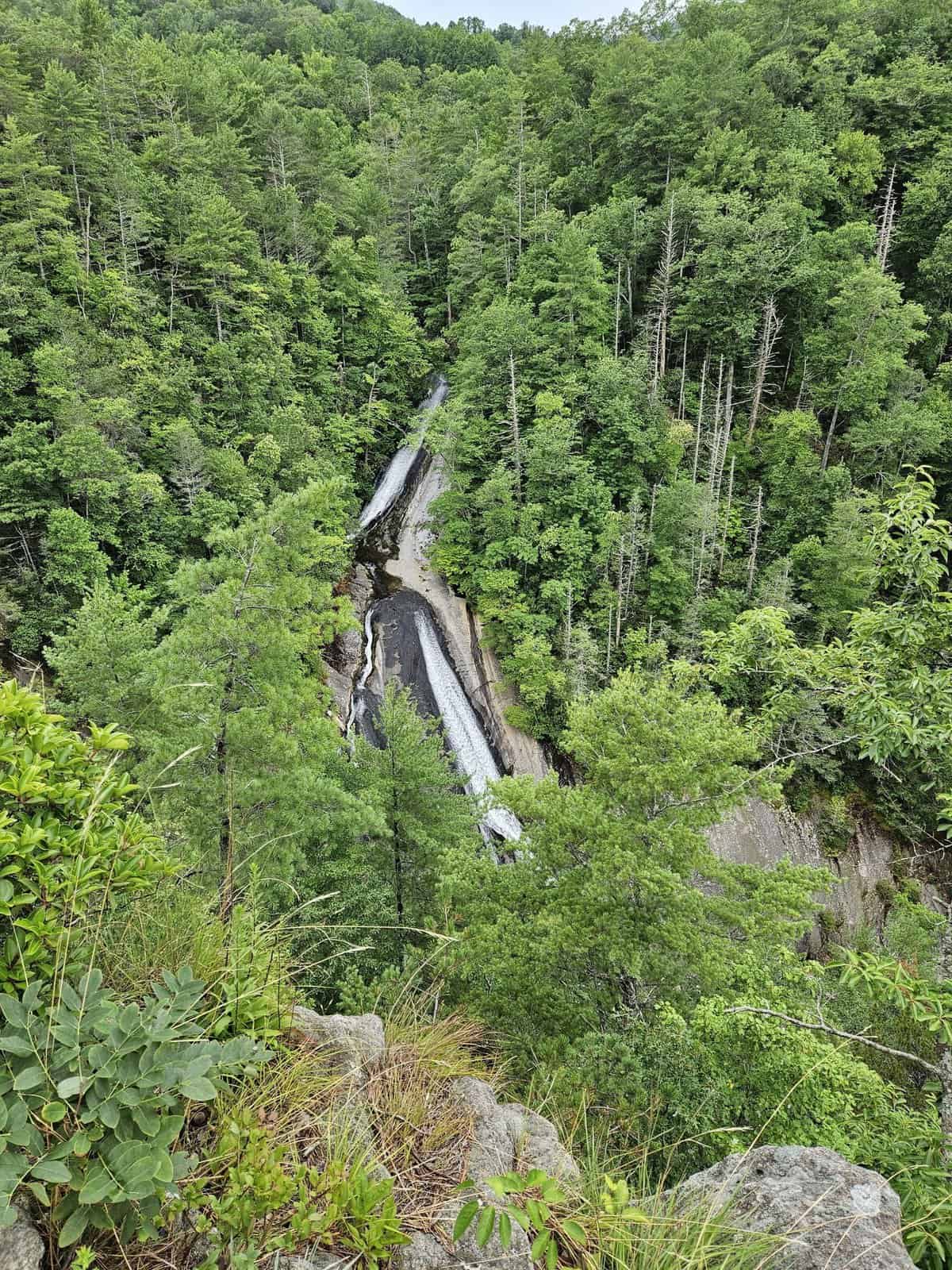
5. Roaring Fork Falls
District: Grandfather Ranger District
Hike Length: Less than 1 Mile
Parking Situation: Available to the left of the gated entrance of the Busick Work Center.
Hike Difficulty: Easy
Location: Located on South Toe River Road.
These beautiful falls are 50 feet high with a long cascade of about 100 feet. There is a beautiful pool at the bottom that makes for an amazing picnic spot. The hike is very easy and more like a short walk to your mailbox than a hike.
Know Before You Go: Best to go after heavy rainfall or the waterfall flow will be very weak and unimpressive.
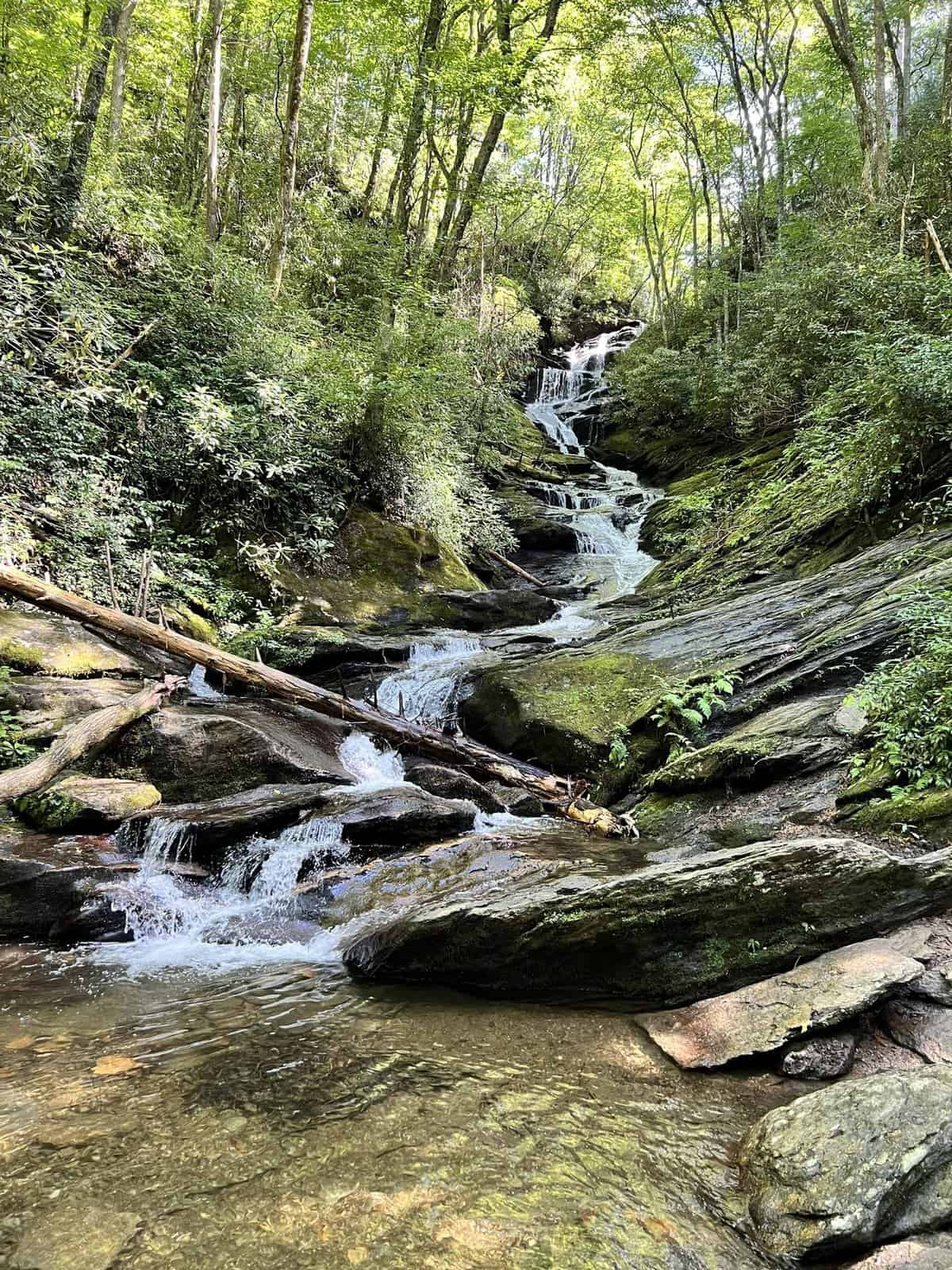
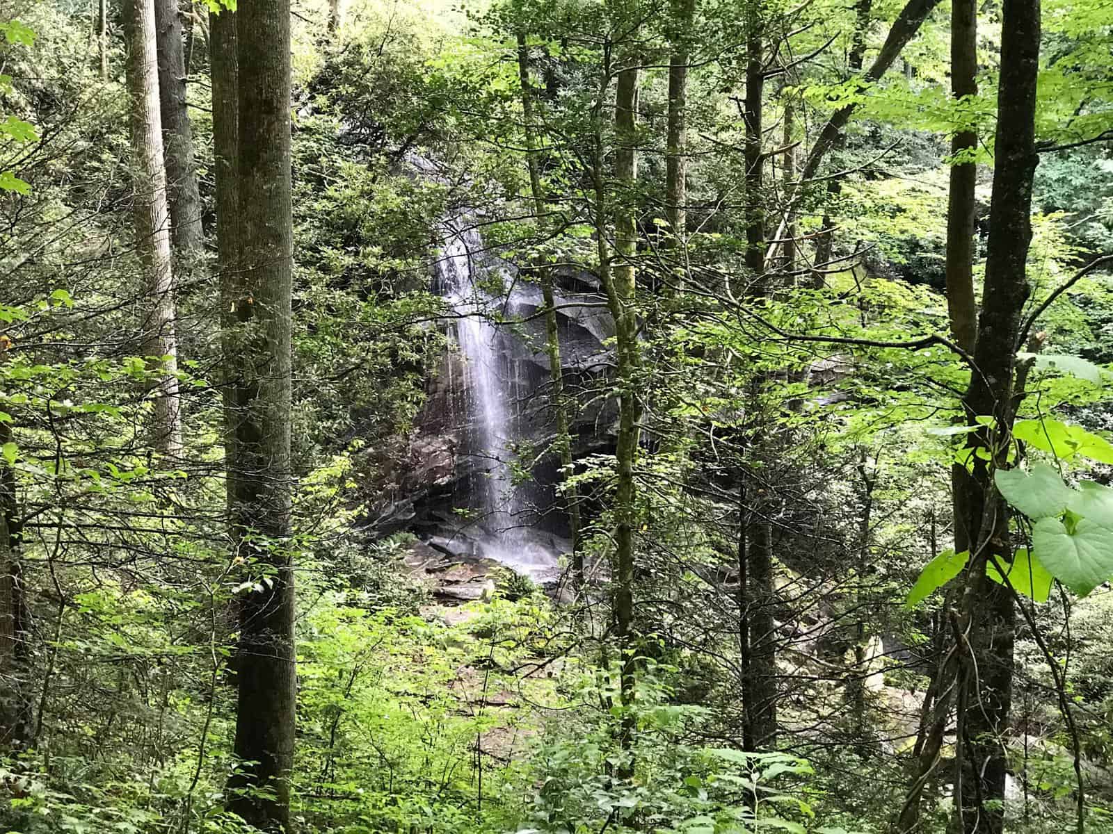
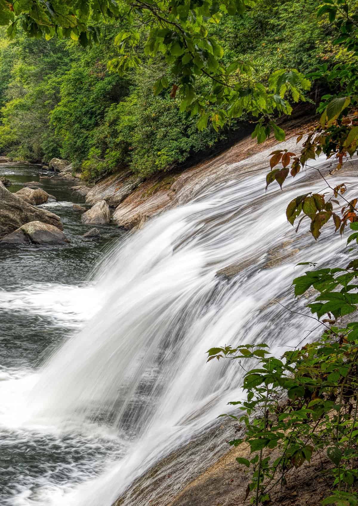
6. Cedar Rock Falls
District: Pisgah Ranger District
Hike Length: Under 1.8 miles
Parking Situation: Parking is available at Pisgah Center for Wildlife Education
Hike Difficulty: Easy
Location: Just off FS 475 which is also known as Davidson River Road.
These small but beautiful falls are 20 feet tall with lots of wildflowers. If you want to keep hiking, you can go all around the Cat Gap Loop, but see our note below.
Know Before You Go: If you want to do the short route to the falls MAKE SURE THAT YOU ENTER THE TRAILHEAD AT THE HATCHERY (to the right of the parking lot if you are facing the forest.)
We entered to the left because #directionallcallenged and we had to do the WHOLE Cat Gap Loop, which ended up taking us 3 hours instead of 30 minutes or so like we planned. That loop is very hard, all uphill and we were incredibly grumpy afterwards with very sore legs for days. I hadn’t eaten anything yet as I planned to have breakfast after the hike, thinking it would be super short. I was so, so wrong.
The waterfall is also very hard to find. Once you cross Cedar Rock Creek on a footbridge you will cross the road and hike for another 10-15 minutes. Then, start looking for a side trail to the left which heads off the main trail at a “V,” and is very easy to pass.
Grogan Creek Falls (below) is about a mile past Cedar Rock Falls.
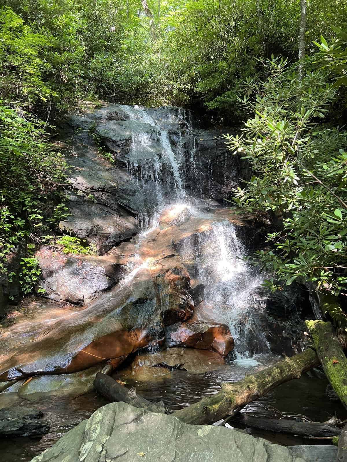
7. Grogan Creek Falls
District: Pisgah Ranger District
Hike Length: 3.7 Miles
Parking Situation: Parking is available at Pisgah Center for Wildlife Education
Hike Difficulty: Moderate to difficult
Location: Just off FS 475
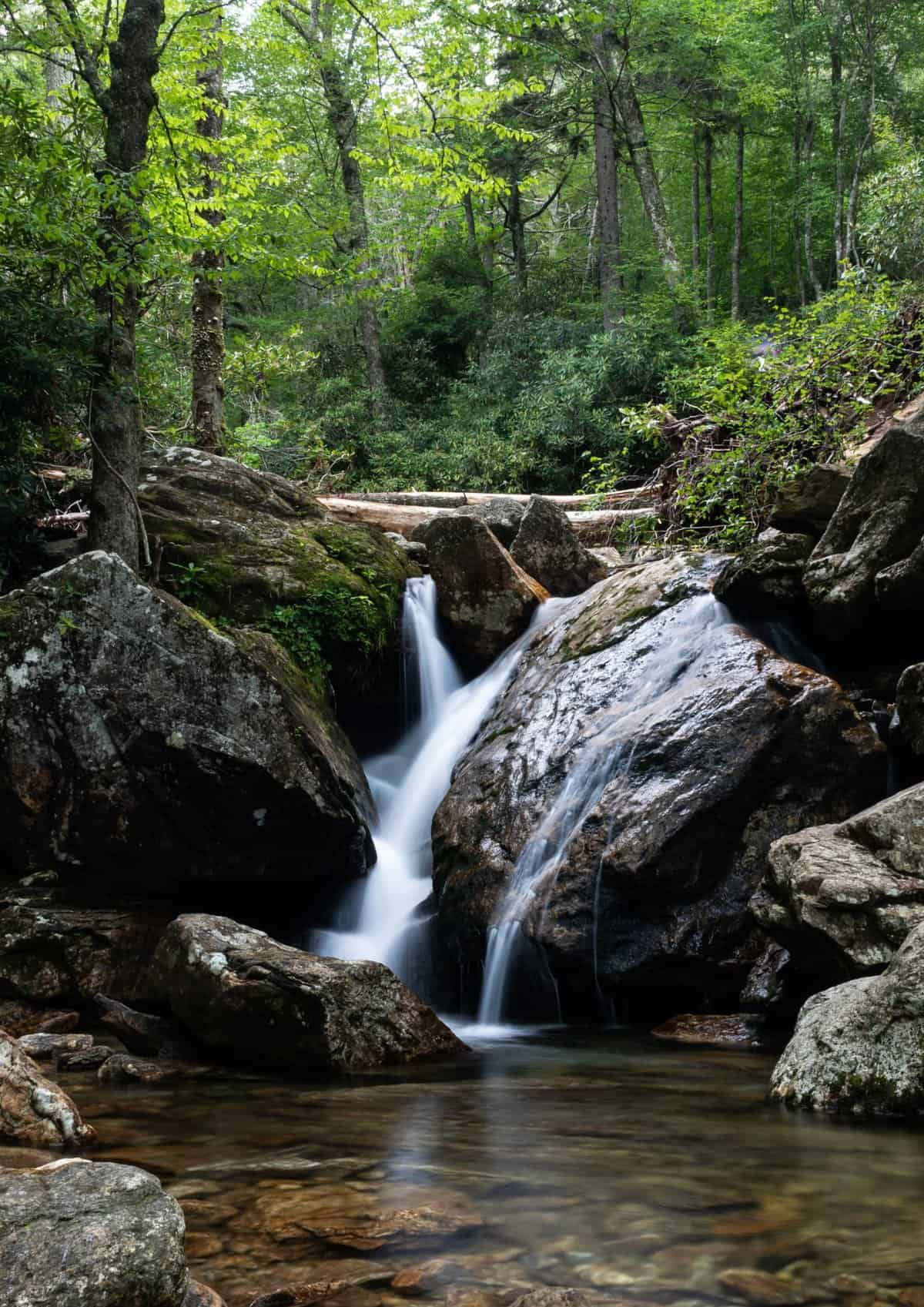
This 20-foot-tall waterfall in the forest is small but very pretty. The water flows vertically down over mossy rockfaces and knee-high ledges.
Know Before You Go: You can keep hiking past Cedar Rock which makes that 2-mile hike 5.5 miles, one of the longer waterfall hikes in the area
8. Cove Creek Falls
District: Pisgah Ranger District
Hike Length: 2 miles
Parking Situation: Small lot across the road from the Cove Creek Campground Sign
Hike Difficulty: Easy
Location: Forest Road 809 – Walk toward the group campsites. At the first creek crossing, turn right onto a side trail.
These falls are 50 feet tall with a nice walking path that is a loop and has the opportunity for detours to other waterfalls around it. This makes it a great spot to go waterfall chasing if you want to see a few of them!
Know Before You Go: As you follow the signs to Cove Creek Falls you’ll hit a fork. Go left to see the very top of the falls, double back, and go right to wind your way down to the base.
It’s important to note that the trails in this area are not as obvious nor well maintained so be prepared to take your time.
9. Daniel Ridge Falls
District: Pisgah Ranger District
Hike Length: 1 mile in and out or 4 miles on a loop
Parking Situation: To reach the trailhead you have to drive beyond the Cove Creek Campground about ½ a mile, and you will come across an open area that is the parking
Hike Difficulty: Easy
Location: Trailhead is off Forest Road 475
These falls are an absolute showstopper and they are SO easy to get to. The falls are short but wide with small offshoots of water cascading down the rock face. You can take a very short hike to see the falls alone or do a loop for a longer hike.
Know Before You Go: To reach the parking area, you will drive beyond the paved road. Do not be alarmed, this is normal. The road is bumpy so we do not recommend going with a low car.
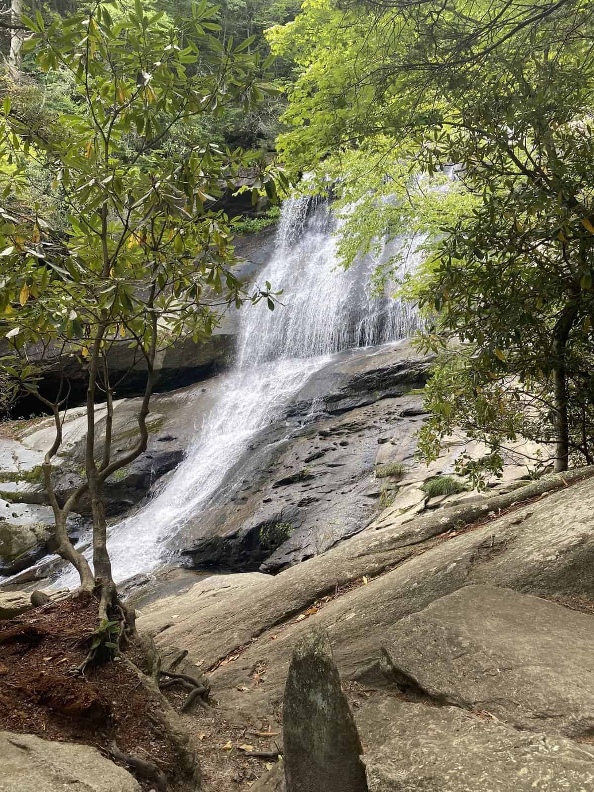
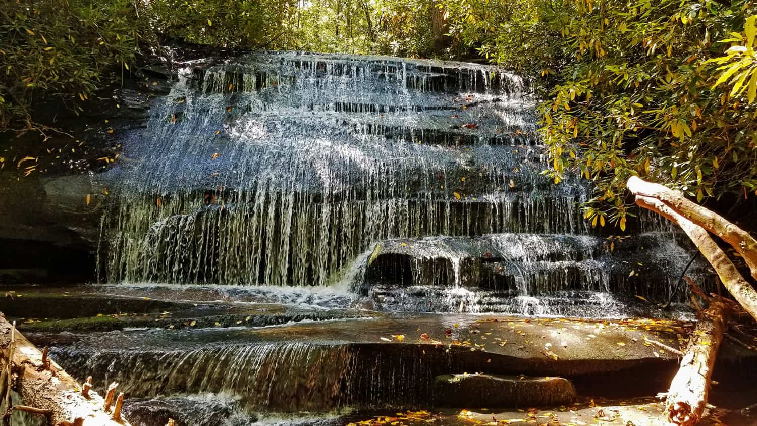
10. Slick Rock Falls
District: Pisgah Ranger District
Hike Length: 2 miles out and back
Parking Situation: There is a very obvious parking pull-off with a bulletin board and you can hear the waterfall.
Hike Difficulty: Moderate
Location: Trailhead is on Forest Road 475B
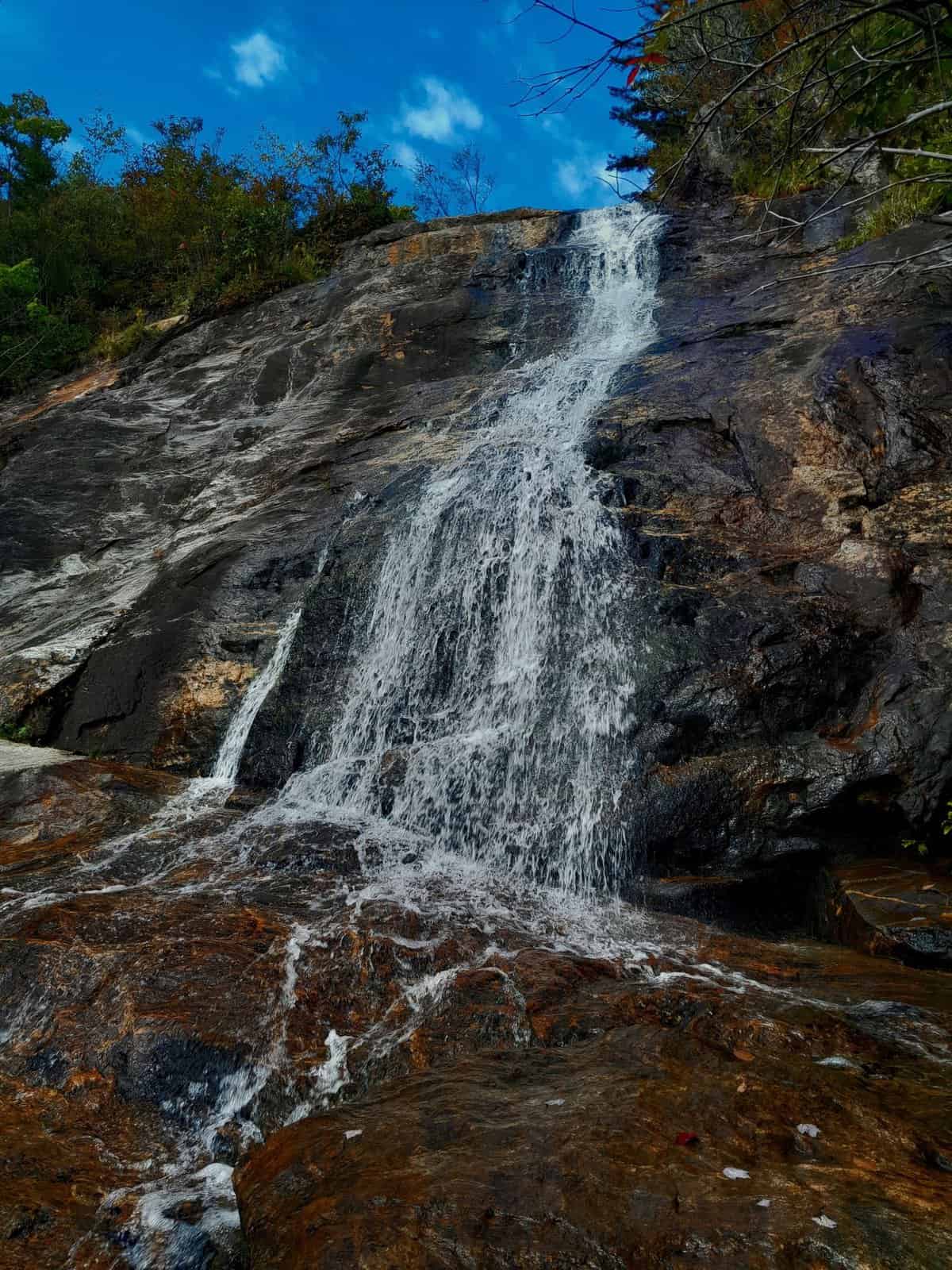
These falls are 35 feet tall and you can walk behind them. In the winter, you can see some pretty epic ice formations!
The falls are named after the slick rocks at the top and bottom of the falls. Long ago, a cattle trail crossed the falls and sometimes stray animals would go over! would be carried over the falls. The Slick Rock Falls Trail (about 3/4 mile) starts here – a popular route for rock
Know Before You Go: Like most falls, these are more impressive after heavy rain so keep that in mind when planning your visit.
It’s also important to note that the main road does often close in the winter so, if you want to see the ice, you will have to hike an extra mile.
11. Log Hollow Falls
District: Pisgah Ranger District
Hike Length: 1-mile roundtrip
Parking Situation: Parking by the gated Forest Service Road 5043. Do not park in front of the gate!
Hike Difficulty: Easy.
Location: Take FS-475B until it crosses with FS-5043 and then walk down to see the falls.
This lesser-visited fall spills 25 feet over rocks. People usually just go to Looking Glass Falls or Sliding Rock Falls, which means this can be a great spot to have by yourself! In late July and into early August you can even snack on wild blackberries!
Know Before You Go: In the winter (January to March) this road is often closed.
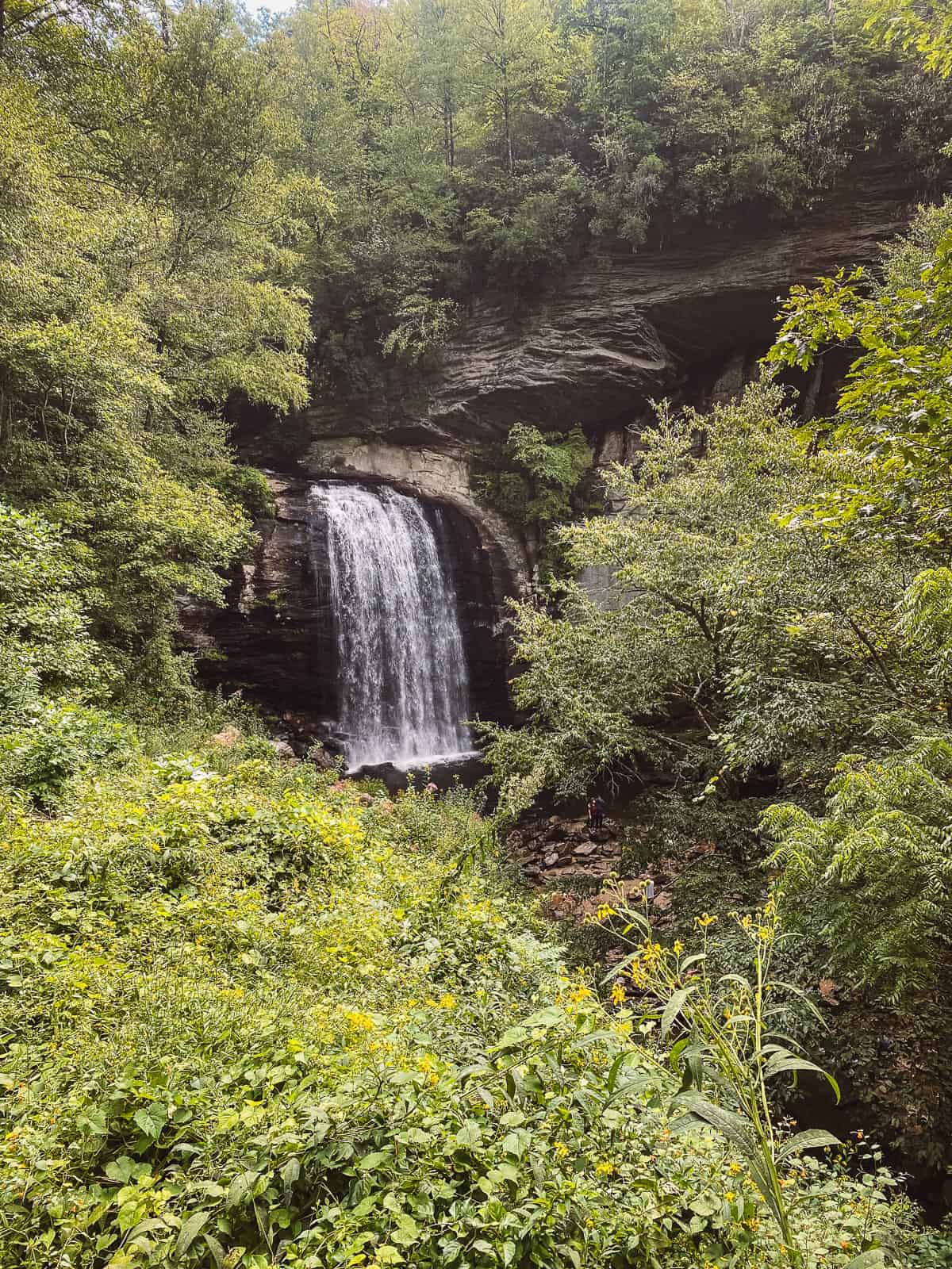
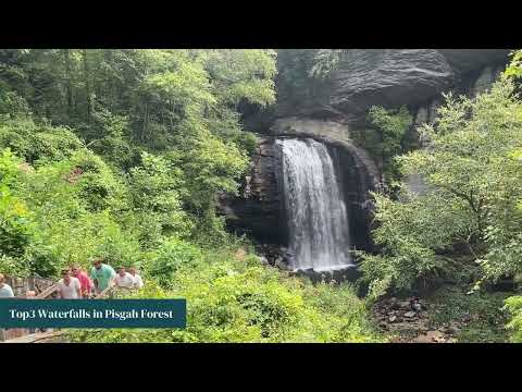
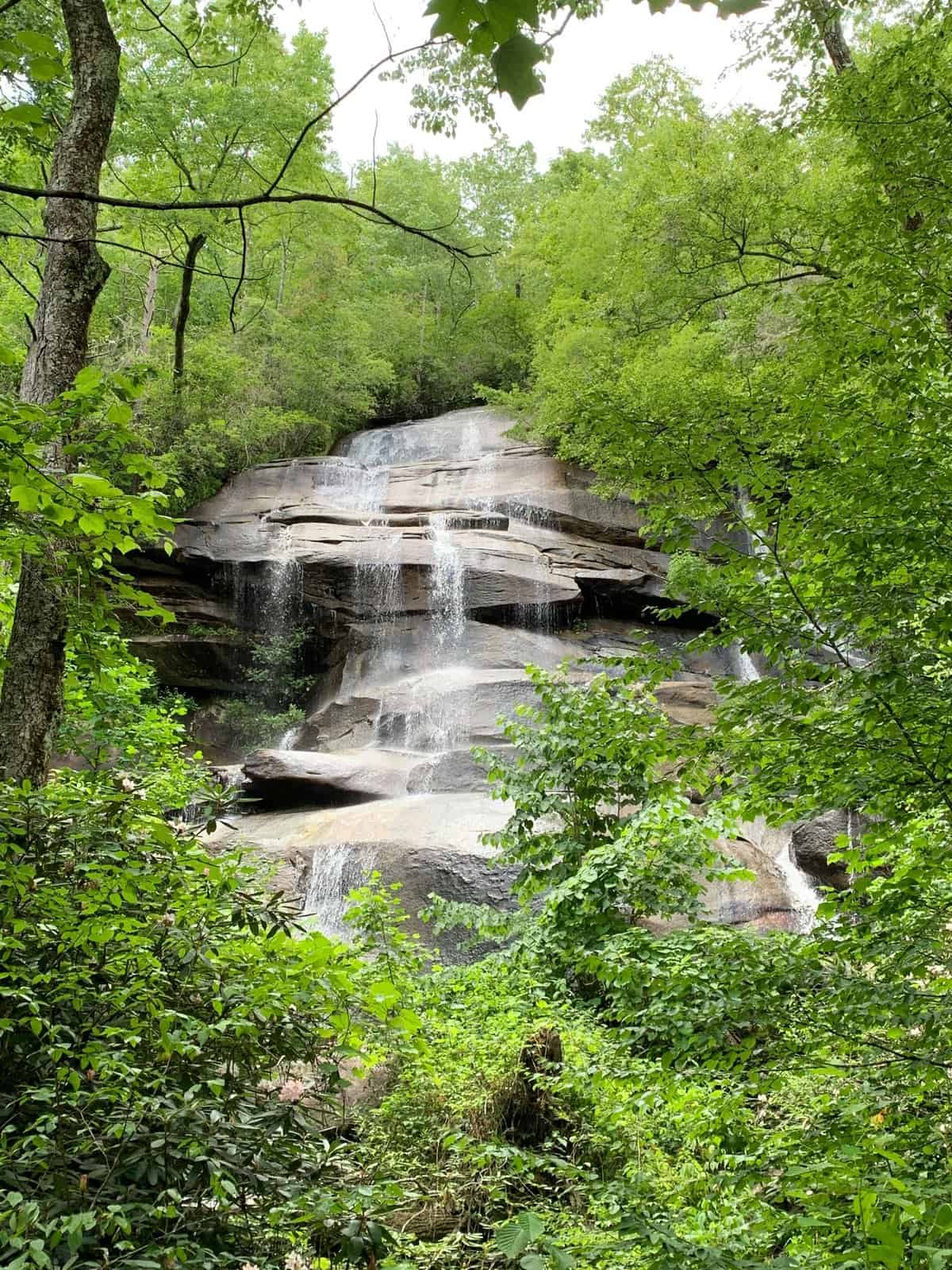
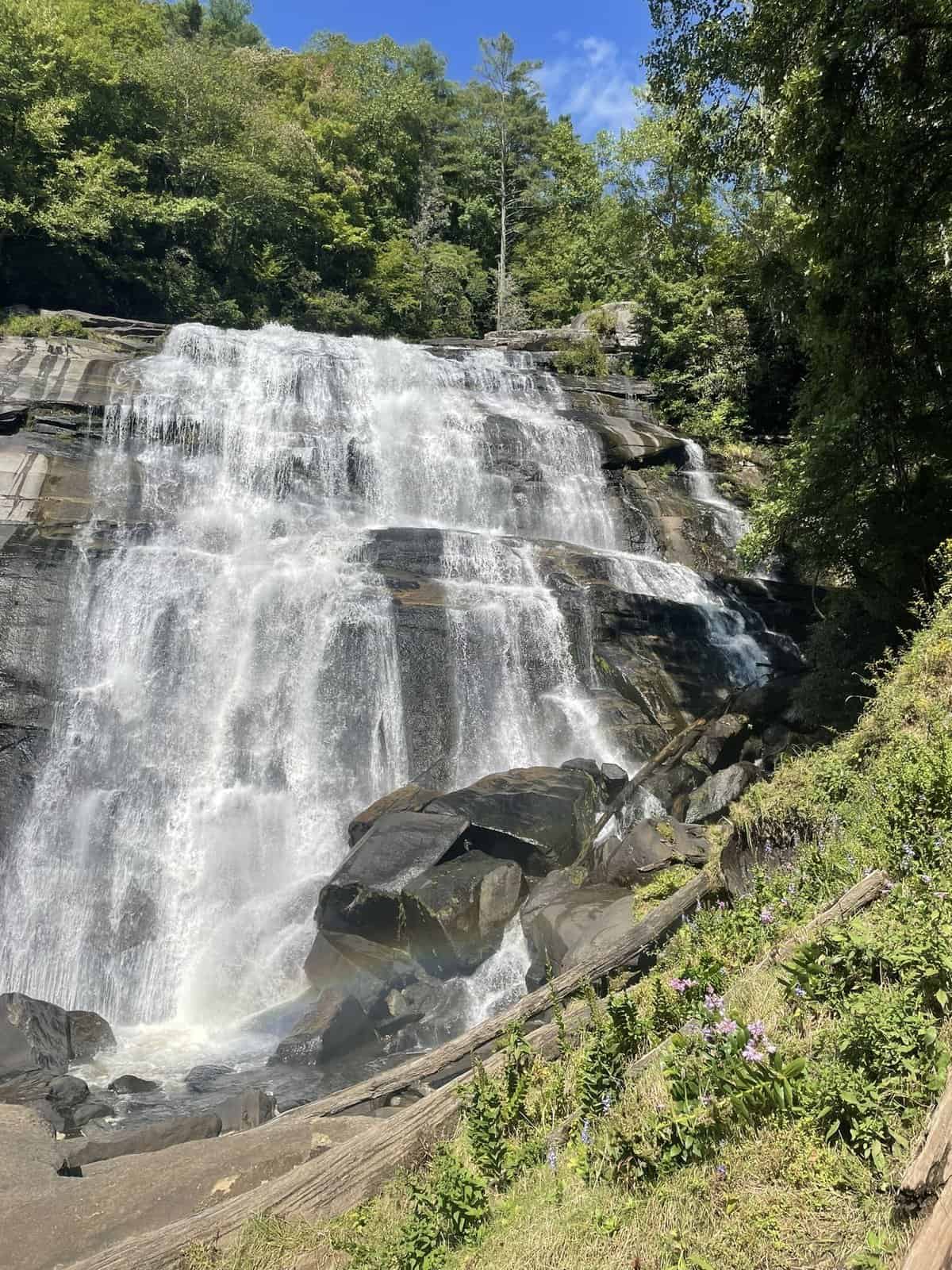
12. Looking Glass Falls
District: Pisgah Ranger District
Hike Length: None. Roadside
Parking Situation: Parking lot on the roadside
Hike Difficulty: Easy
Location: On the side of US Highway 276.
Pisgah National Forest Looking Glass Falls is a 60-foot waterfall that is extremely popular as you do not even need to hike to it! You can simply park on the side of the road to admire its beauty. It gets very, very busy so we recommend hanging out somewhere else!
In the winter water freezes on the side of Looking Glass Rock to create a mirror-like effect, which is where this fall gets its name.
Know Before You Go: You can see it from the roadside but some steps take you closer with an amazing view or to swim in the pool.
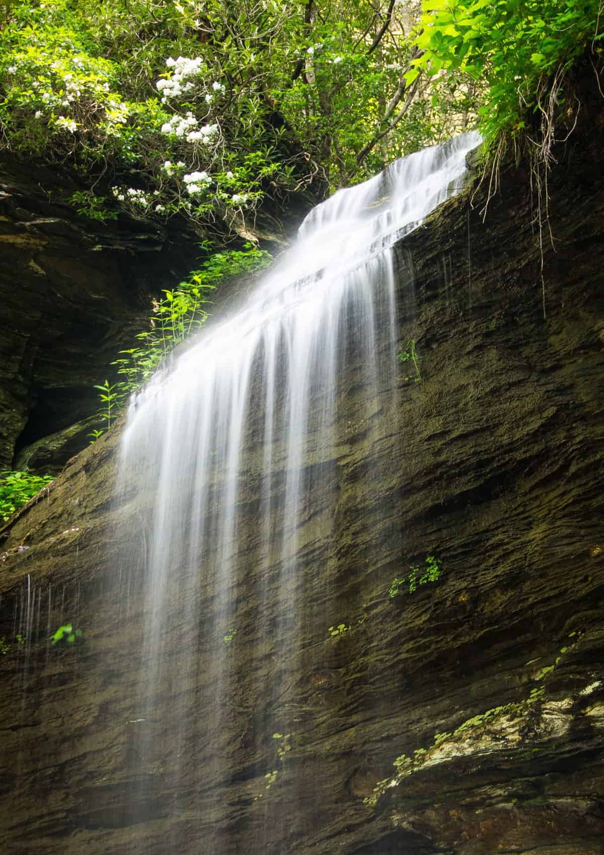
13. Moore Cove Falls
District: Pisgah Ranger District
Hike Length: 1.4 Miles
Parking Situation: VERY hidden lot. The landmark to note is a low stone bridge with a parking area to your right just before the bridge. You will see a wooden information board near the parking area.
Hike Difficulty: Easy
Location: Trailhead is on US 276.
This forest falls waterfall is near Looking Glass Falls and people get so busy with those falls that they don’t come to this 50-foot hidden gem. You can walk behind the waterfall and the trail has tons of beautiful wildflowers!
Know Before You Go: You can easily combine this with Looking Glass Falls and Sliding Rock Falls as all 3 are located within 2 miles of each other.
To note: there is a path to the left of the falls that goes to the top but is not recommended. It is very slippery and you could die. Dramatic? Maybe. But do you want to risk it?
14. Sliding Rock Falls
District: Pisgah Ranger District
Hike Length: Less than 1 Mile
Parking Situation: Parking lot.
Hike Difficulty: Easy
Location: The trailhead/lot is located on US 276
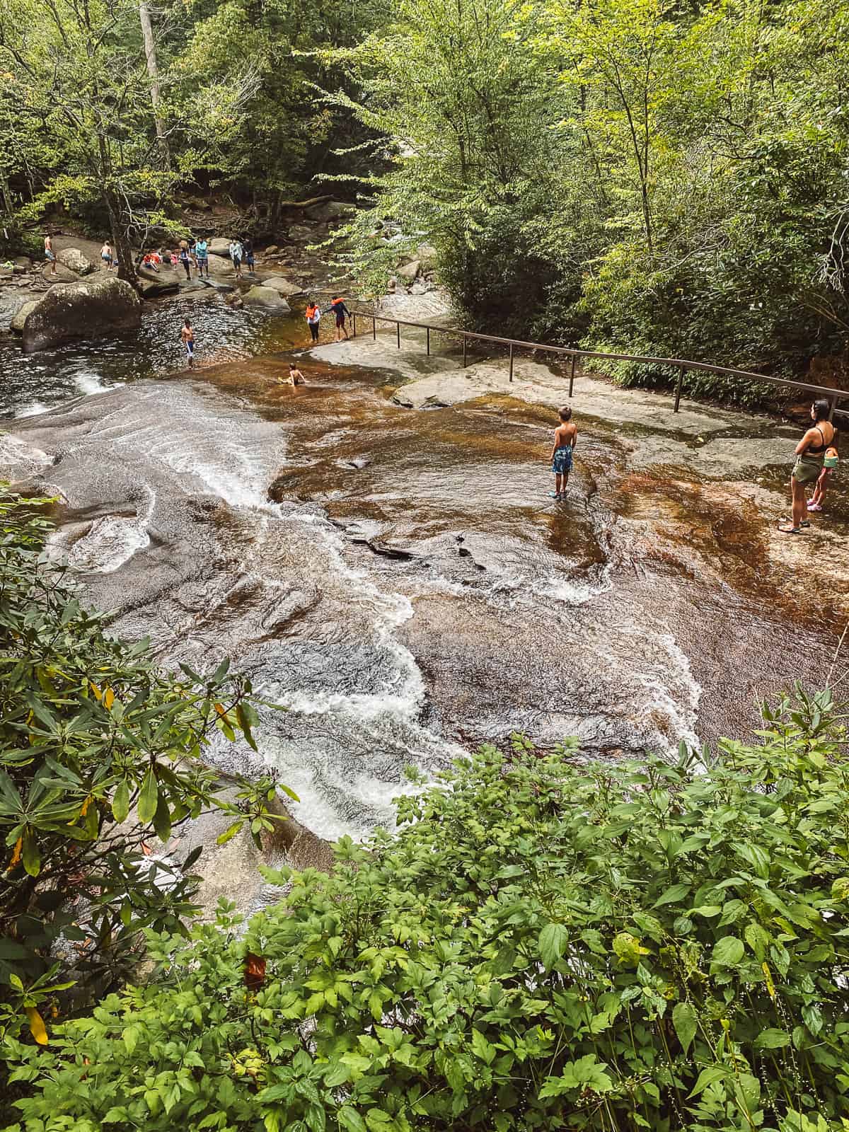
This is one of the most popular Pisgah National Forest Waterfalls because it is 60 feet and it’s so smooth you can use it as a natural water slide which people do. The pool is 8 feet deep at the bottom and is very unique and beautiful!
Know Before You Go: In the summer, it has lifeguards and a $5 entrance fee and there were a lot of families with little kiddos which is not our vibe.
15. Twin Falls
District: Pisgah Ranger District
Hike Length: 4.5 Miles roundtrip (you can also take a 6.5-mile loop which is steeper.)
Parking Situation: There is a very small parking lot located just past the Pisgah Forest Riding Stables
Hike Difficulty: Moderate
Location: The trailhead (Avery Creek) is on FR 477
Two waterfalls for the (free!) price of one? Sign us up! The Twin Falls is made up of 2-100-foot tall waterfalls that you can see at the very same time!
Know Before You Go: This hike includes seeing another fall: Avery Falls so it’s kind of a 3 for!
16. Skinny dip Falls
District: Pisgah Ranger District
Hike Length: .9 miles roundtrip
Parking Situation: Has a parking area.
Hike Difficulty: Easy to moderate
Location: The parking area is at Milepost 417
Skinny Dip Falls was a gorgeous swimming hole that felt like a tropical destination! However, it has been mostly destroyed by massive flooding and now only a few small cascades remain.
17. Graveyard Falls
District: Pisgah Ranger District
Hike Length: 3.3 miles round trip (loop)
Parking Situation: Has a parking lot.
Hike Difficulty: Moderate
Location: The parking area is on the Blueridge Parkway at milepost 418.8
Graveyard Falls was named for Graveyard Fields, it’s water supplier, where there used to be treestumps that looked like tombstones in a graveyard. The hike to the falls is loaded with wildflowers blueberries and blackberries in the late Summer.
Know Before You Go: It’s one of the few hiking spots in the parkway area that has restrooms, so take advantage of that!

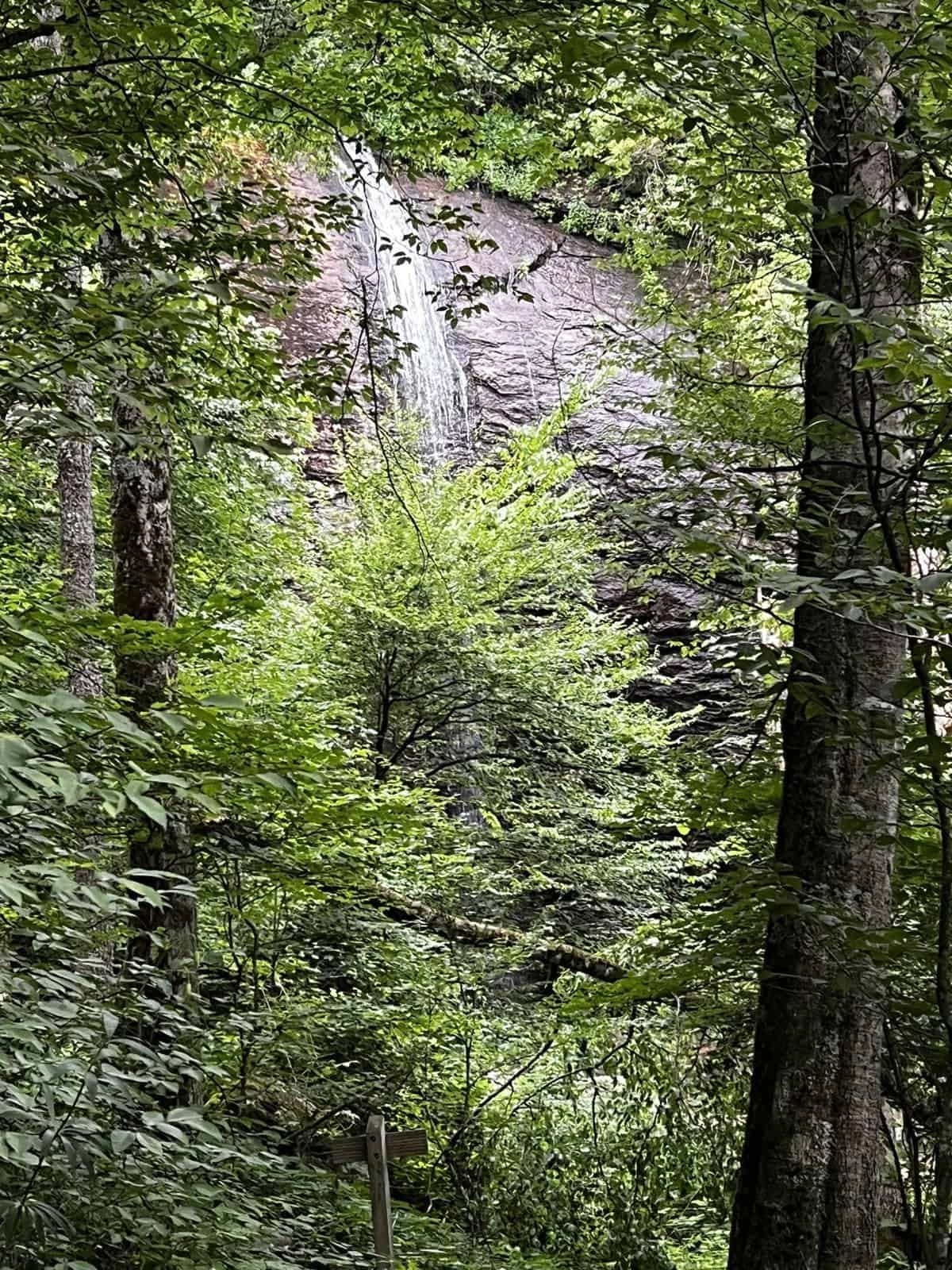
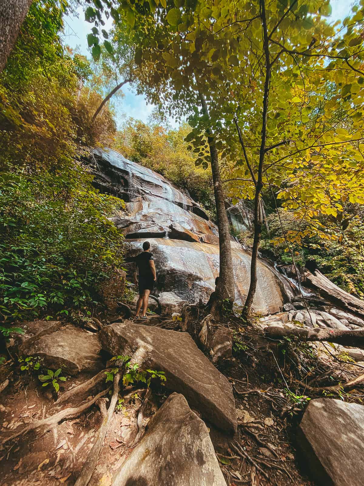
18. Cathey’s Creek Falls
District: Pisgah Ranger District
Hike Length: Under 1 mile
Parking Situation: Unmarked pull-off.
Hike Difficulty: Easy (short but steep)
Location: The pull-off is off Forest Service Road 471. You will see the sign for Forest Service Road 471 that marks the start of the national forest.
The waterfall is 80 feet tall and inside a beautiful cove that you can hear from the road, but cannot see it. It is part of a lesser-visited area inside Pisgah National Forest.
Know Before You Go: This hike is very very short and is more like a steep path than a hiking trail.
19. Courthouse falls
District: Pisgah Ranger District
Hike Length: 1.4 miles roundtrip
Parking Situation: Has a pull-off for parking
Hike Difficulty: Moderate
Location: The trailhead is 3 miles up FR 140, just after a bridge.
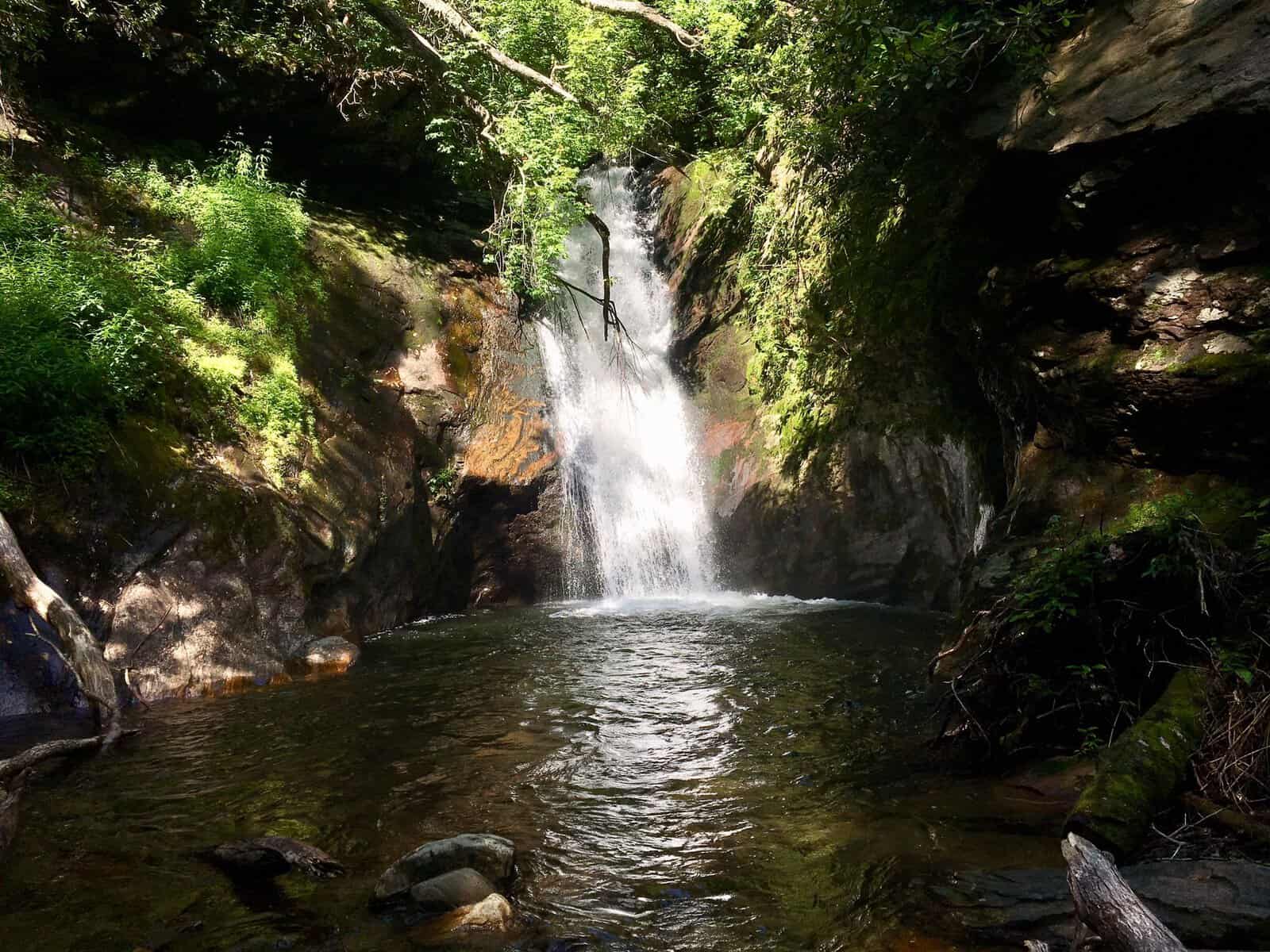
45 feet tall and set inside a beautiful cove, Courthouse Falls is a site to behold. The waterfall plunges into a deep pool that is perfect for swimming. This area is more remote which makes it great for a waterfall date!
Know Before You Go: The road is often closed in the winter and early spring and the road is quite bumpy so not the best bet if your car is low to the ground.
20. Turtleback falls
District: Pisgah Ranger District
Hike Length: 2.5 miles (1.5 miles to Rainbow Falls and an additional 1 mil roundtrip to Turtle Back)
Parking Situation: Has a parking lot
Hike Difficulty: Moderate
Location: Inside Gorges State Park. You will see signs to Rainbow Falls Parking Area to park and that is where the trailhead is.
This low waterfall cascades over a curved rock that looks like a Turtle shell, hence the name. People love to slide down the falls and into the pool below, making this a very popular spot during the summer months.
To note: state park rangers warn against doing this as there have been many injuries and deaths here. It is not prohibited but you may want to enjoy the falls from surrounding rocks!
Know Before You Go: If you swim, the currents are VERY strong so be super careful! You should be a very strong swimmer and no children should be allowed to swim.
21. Rainbow Falls
District: Pisgah Ranger District
Hike Length: 1.5 miles each way
Parking Situation: Has a parking lot
Hike Difficulty: Moderate
Location: Inside Gorges State Park. You will see signs to Rainbow Falls Parking Area to park and that is where the trailhead is. (The park changes from Gorges State Park to Pisgah about 20 minutes after you leave the lot.)
This is known as one of the most beautiful falls in all of the Blueridge Mountains. The Horsepasture River runs down a 125-foot drop and the mist creates a rainbow effect, which is where the falls get their name!
Know Before You Go: Make sure to walk 10 more minutes past Rainbow Falls to see Turtleback Falls. You should also be aware that you will cross some creeks so you may get wet feet! Make sure to bring waterproof shoes!
Recommended Itineraries
There are quite a few waterfalls on this list and unless you have secret teleportation powers (ugh, jealous!) you won’t be able to visit them all in a day.
So, I grouped them all into categories that you COULD do each day with recommended home bases to see the waterfalls from. Grab those romantic road trip questions and head out on a bit of a drive to see some natural beauty!
Group 1 – Recommended home base: Linville (ideally) or Banner Elk
- South Harper Creek Falls
- Upper Creek Falls
- Elk River Falls (this would be a lot of driving if you did this in one day but it could be done! You could also do this separately)
Group 2 – Recommended home base: Brevard (ideally) or Asheville
- Cedar Rock Falls
- Twin Falls
- Cove Creek Falls
- Daniel Ridge Falls
- Grogan Creek Falls
- Skinny Dip Falls
- Log Hollow Falls
- Sliding Rock
- Looking Glass Falls
- Slick Rock
- Graveyard Falls
- Moore Cove Falls
- Cathey’s Creek Falls
- Courthouse falls
- Turtleback Falls
- Rainbow Falls
Stand-alone – Recommended Home Base: Barnardsville (ideally) or Asheville.
- Douglas falls.
Stand-alone – Recommended Home Base: Barnardsville (ideally) or Asheville.
- Roaring Fork Falls
This is best visited if you are already driving the Blueridge Parkway. It’s short so not worth a day out just to see it,
Map Of The Waterfalls
I have created a map of all the falls in this list and color-coded them so you can see the groupings suggested above and plan accordingly. The houses on the map represent the recommended home base cities as listed below.
How to use the map: Use your computer mouse (or fingers) to zoom in or out. Click the arrow on the top left corner for the index. Click the star next to the map’s title to add it to your Google Maps account. To view the saved map on your smartphone or PC, open Google Maps, click the menu and go to ‘Your Places’/’Maps’. If you want to print the map or see it in a bigger window, click on ‘View larger map’ in the top right corner.”

How we can help you next:
When you’re visiting the Asheville area, you may be considering visiting the Biltmore Estate, yah? Check out of honest guide on visiting to determine if it’s the right stop for you!
Do you think you’ll visit Pisgah Forest to check out some of its beautiful falls?
Other Posts You Might Like: